
Home › Tools › Houses and roads as DXF
Houses and roads of an area as DXF, georeferenced
Zoom in on a village, a district or a route: the map tool gets the house footprints (Google, Bing and OpenStreetMap) and the roads and tracks from OpenStreetMap with their width, shows them on the satellite image, then exports them as DXF in your system (UTM, a national grid…) or in KML. The preview is free; exporting the imports is included in Premium.
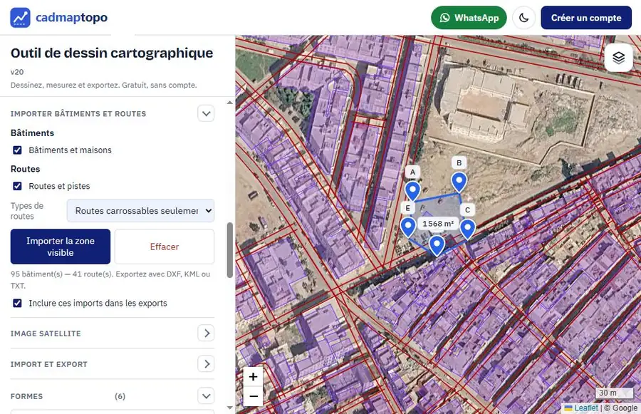
Open the map toolThe “Import buildings and roads” section opens directly.
What you get
- The houses: building outlines detected on satellite imagery (open datasets from Google and Microsoft Bing) or drawn by the OpenStreetMap community. You choose which datasets to use.
- Roads and tracks from OpenStreetMap: drawn as two edges at the width of the road, as edges and centreline, or as centreline only. When the width is not given, it is estimated from the road type.
- A clean DXF: separate layers for buildings, road edges and road centrelines, coordinates in the chosen system, elevation on every vertex.
In four steps
- Open the tool, search for the place and zoom in on the area (level 16 at least).
- In “Import buildings and roads”, tick the building sources and the roads.
- Tap “Import the visible area”: houses and roads appear on the satellite image, for free.
- Choose the system in Import and export and download the DXF or the KML (Premium members).
For which projects?
Studies of drinking water and of sewerage of villages (spot the houses to serve, draw the pipes along the tracks), location plans and site plans, preliminary designs of roads and utilities, building census. Combined with the contour lines as DXF, you get a complete base map in a few minutes to start a project.
Frequently asked questions
Is importing houses free?
The preview is free: you see the houses and roads on the map. Exporting these imports to DXF, KML or KMZ is for Premium members.
Where do the building footprints come from?
From open datasets: buildings detected automatically on satellite imagery (Google, Microsoft Bing) and OpenStreetMap buildings. Roads come from OpenStreetMap.
Is the DXF georeferenced?
Yes: choose UTM, Merchich Lambert (zones 1 to 4) or another system in Import and export; the DXF opens in place in AutoCAD, Covadis or QGIS.
How many houses can be imported?
Up to about 8,000 buildings per import: for a large area, import in pieces by moving the map.